Landsat – 9 will take over Landsat – 7’s role and continue to monitor minute changes in Earth’s ecology and landscapes from its location over 700 kilometers in the sky.
Since the 1950s, NASA satellites have been keeping a continuous eye on our planet from space, something that has become increasingly important in recent years due to climate change.
Since 1980, Landsat has illustrated the changing landscapes of the Earth, including urban sprawl, forest decline, glacier retreat, and mountain and desert changes.
From wildebeests in the African savannah to walruses in Antarctica, it has been used to monitor their behavior and habitat. NASA has stated that this program is the most economically important in Earth science history. Though there have been many technically advanced imaging satellites, none have come close to Landsat in terms of longevity and reliability.
Some of the stunning images captured by Landsat
Coastal Colour in New Zealand.

Credit: NASA/USGS
Landscape in Southern Louisiana.

Credit: NASA/USGS
Fire Consumes Large Swaths of Greece.

Credit: NASA/USGS
The first Landsat satellite, formerly known as the Earth Resources Technology Satellite, was launched in July 1972 as a joint effort by the United States Geological Survey and NASA. Seven more satellites have been launched in the last five decades to replace the last. In 1982, Landsat -4 became the first satellite capable of capturing details as small as 30 meters across.
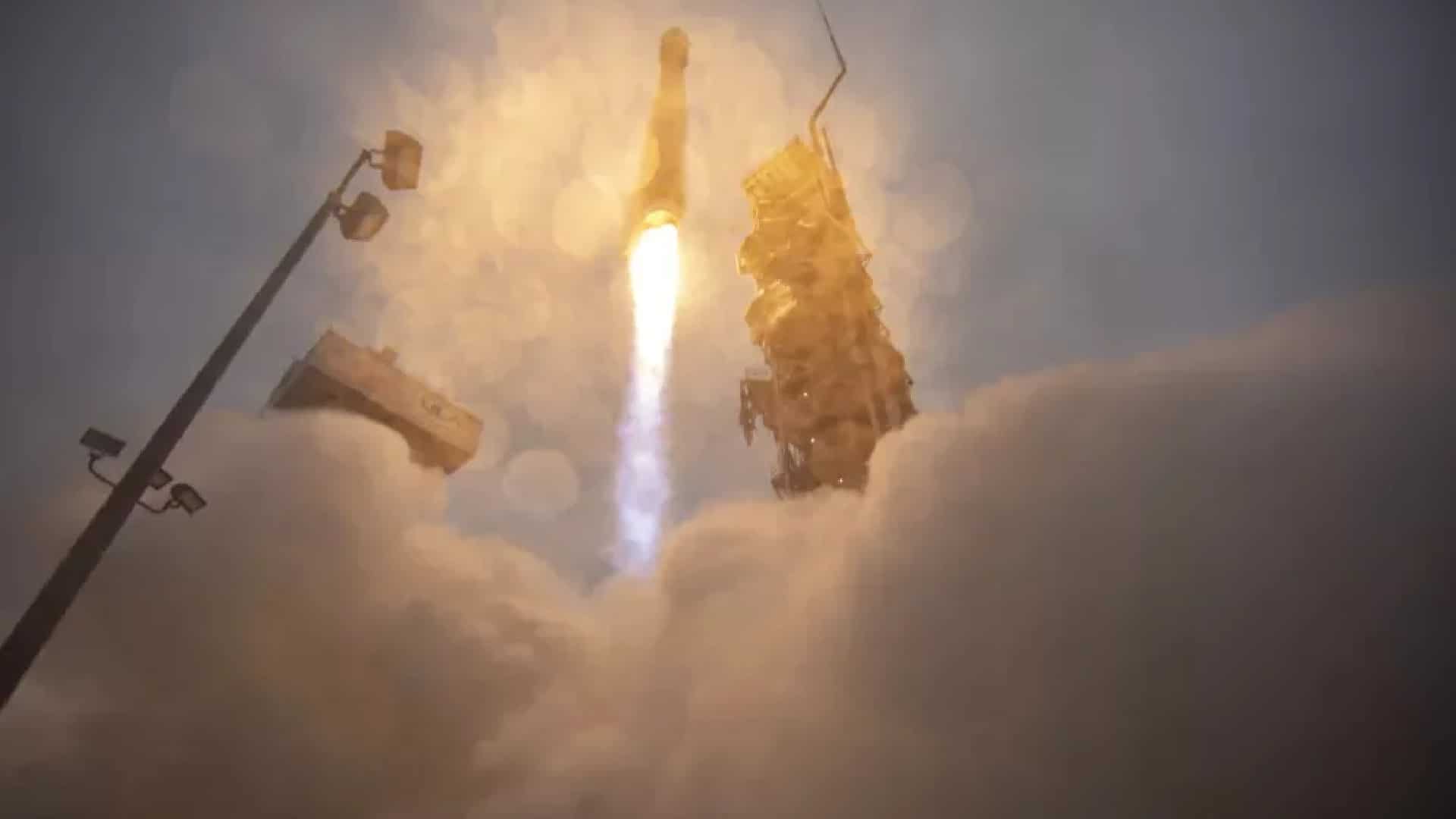
As of this morning (02:12 P.M. EDT, Sep 27), Landsat – 9 successfully launched from Vandenberg Space Force Base in California and made it into orbit.
Located at an altitude of 700 kilometers above sea level, Landsat – 9 will begin collecting images of the planet along with its predecessor, Landsat – 8, launched in 2013, and will eventually replace Landsat – 7, launched in 1999.
https://i.imgur.com/HCNQRL9.gif
Landsat Timeline. Credits: NASA
NASA estimates that the mission will cost around $750 million and will be equipped with two critical instruments – the Thermal Infrared Sensor 2 and the Operational Land Imager 2. Both instruments can detect minute changes in world ecosystems such as lakes, forests, and rivers.
“We’ve assembled a fascinating history of how the planet has changed over the last half-century,” said Dr. Jeff Masek, a project scientist for the program. “We can see how natural disturbances occur, such as fires, hurricanes, and insect outbreaks, and then how ecosystems recover for decades afterward.
“And we can look specifically at the impact of climate change on ecosystems,” he said. A warming climate has increased plant cover at high latitudes, but vegetation has declined in water-limited semi-arid environments.
Landsat’s stunning images can be seen here.